States are important to me. California is my home of birth. I am first an American, but states have been crucial to my life. Arizona is my home of coming-of-age. Montana is the locale of my current residence. My stack of red DeLorme Atlas & Gazetteers is a reminder of my good fortune to visit many of our Western states.
State boundaries have been oddly drawn. Instead of seeking to enhance the land and its peoples, political and wealth connections have often determined the outcome.
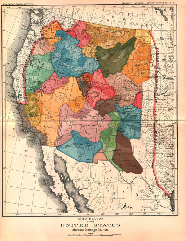
John Wesley Powell is the intellectual father of the Bureau of Reclamation. In the late 19th century, he surveyed the arid American West, warning that traditional farming methods wouldn’t work without massive federal water management. He knew the West well. It was dramatically arid west of the 100th Meridian, the middle of Kansas. He suggested drawing boundaries according to watershed.
Today’s rampant drought on on-going water piracies make him look prescient.
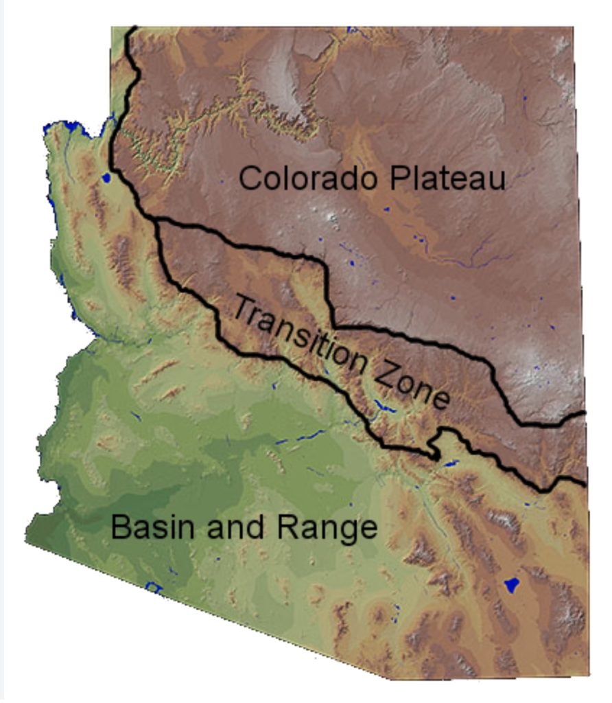
Here is how Arizona was built. The Colorado Plateau (north) is the Rio Colorado, high country, desert and forest, the Grand Canyon (another page), the Four Corners, and Athabaskan/Puebloan peoples. The Transition Zone is the Verde River, a mixture of desert and mountain, historically wealthy from mineral upwellings. The Basin and Range (south) is the Gila River, the land of the deserts, Sonoran and Chihuahuas, Saguros, Heat.
Across these zones Arizonans have promoted and chased their “5 C” slogan: “Copper, Cattle, Cotton, Citrus, and Climate”. (I’d add “Corn”, in honor of native peoples.)
(Please feel free to leave comments…use vspcom1@gmail.com for email)
All Images & Stories Are ©VicSmithPhoto