I am not a photographic homesteader, I don’t choose wild country in order to hew new life from the wild. I am a diligent student and a treasurer of mentors. I appreciate those who’ve carved a path, those from whom I can learn.
It was the mid 1990’s and I was newly single, two college boys, chasing some definition of life beyond work. I did what single guys sometimes did: hit the road. My brother had spent wonderful times in the Sierra Nevada Mountains. My parents had each had cameras with which they’d captured and shared memories. I’d just migrated from an 35 mm film into a 6 cm x 6 cm film. I was enthusiastic, but not yet trained.
So off I went, hoping for vitality, up the San Joaquín Valley and over Sonora Pass. Near the crest I spotted a sign for a trailhead. The trail went to the edge of white granite cliffs and then down to some part of the Stanislaus River below, down through the granite boulders marked with occasional bright orange circles. I was enthralled and overwhelmed.
After climbing back up, I went on the Mammoth Lakes in the Eastern Sierra, to meet my brother and his family. Mammoth had fascinating shops. I bought my first Patagonia parka there. I then wandered into a small travel store, The Great Outdoors. The owner, Rick Knepp, greeted me in his booming baritone voice and showed me his wares: my first wood walking stick (that I still have), a beautiful granite vase with some colorful imitation Sierra wildflowers (still on my office bookshelf), and a poster.
…and a poster. He would be leading a tour just up the highway come the Fall. His flock would gather near the shores of Mono Lake to see the Lake’s mysterious Tufa columns, watch its migratory seagulls, and travel under its Fall colors. It would include instruction and coaching. He seemed like the kind of teacher who could move me on in my explorations. So I signed up to return.
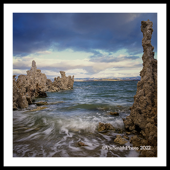
As it turned out, going back to Mono Lake was a trapdoor. Rick’s vision would enthrall me. This land of immensity, where the Sierra Nevada Mountains jut up from the Great Basin Desert, making the rain shadow that creates this desert, would net me. I would return again and again to spend time with Rick in his powerful Eastern Sierra. The Mono Lake Committee would eventually include some of my images in their calendar. I would meet and follow other world class of photographers chasing the magic power of the landscape .
Here are some of the results of my wanderings.


All Images & Stories Are ©VicSmithPhoto